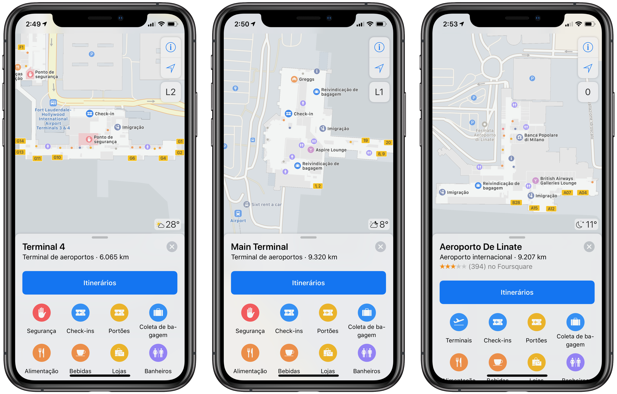
At the end of last year, we commented that Apple adopted a new way of collecting data for its maps, in addition to the typical cars that circulate in some regions: people on foot. The novelty, which is part of the reconstruction process of the Maps app, also gained a new page with information about the next places that Apple will visit.

Previously, both data collected by vehicles and by pedestrians were disclosed on the company’s car fleet page; now, the entire image collection schedule (separated by regions) can be accessed on this page.
In it, Apple reveals some new information, including that pedestrian data collection began last month in the American states of Hawaii and Nevada, and will continue until next month. Vehicle collection will also reach the small European country of Andorra, located between southern France and northern Spain, next April.
The new page also indicates that Apple «will periodically revisit some locations to collect new data, in an effort to maintain a high-quality, up-to-date map.»
Public transport and indoor maps
Recently, more regions in the United States have gained support for public transit information, as detailed on the iOS resource availability page. More precisely, this feature is now available in: Alaska, Connecticut, North Dakota, South Dakota, Delaware, Florida, Georgia, Illinois, Indiana, Kentucky, Mississippi, Missouri, New Jersey, New York, Oklahoma, Rhode Island and Texas .

Apple has also expanded its indoor airport maps to several new regions in the US, Australia and Italy. They are, respectively: the Fort Lauderdale-Hollywood International Airport (FLL), The Newcastle International Airport (NCL) it’s the Milan Linate Airport (LIN).
While the number of new airports supporting Apple’s internal maps was small, the list of shopping malls that won the feature was quite extensive. In general, users from several states can now view internal maps of the local shopping center; more cities from Australia, Italy and Japan have been included, see the full list of locations here.
Final collection in the USA
As you can see, the USA is usually always included in the list of map expansions; after all, this is the country of origin of the Apple. Since when it started using vehicles equipped with LiDAR sensors, more than three years ago, Apple has partially covered 45 of the 50 American states to date.
With recent expansions, that total is expected to increase in the coming months, as Apple has confirmed that it will begin collecting data from Alaska, South Carolina and Tennessee between March and July this year. In addition, the company will continue to expand its resources in seven other US states during this period.
In this sense, two states are still missing to complete data collection throughout the American territory: Arkansas and Oklahoma. However, everything indicates that Apple is already operating in these locations, according to users who have collected images of the company’s vehicles there (although it is also possible that these cars have not collected any data).
If all goes well, Apple should launch its (enhanced) map service in the U.S. next year; there is still no forecast of when this expansion will arrive here, in Brazil, or even in Portugal.
via MacRumors: 1, 2, 3
