Apple is really not sparing efforts to renew its application Maps with their own, more accurate and reliable data, and one of the most important parts of this initiative is the company’s capture vehicles, which circulate on the streets of cities around the world collecting information. Now, as the 9to5Mac, they are about to reach yet another country: the Canada.
Apple announced that Apple Maps vehicles will start rolling around the country in the summer in the northern hemisphere, which will begin next month; a statement posted on its official website and in several Canadian newspapers states that the information will be added in a “future product update” and that the company follows all local data collection laws, including blurring faces and license plates on the captured images .
According to Apple, the Canadian invasion of the company’s vehicles will take place in all 10 provinces of the country, and the work is expected to continue until November 2019. It is not known when the maps of Canada will be updated on the Apple platform, but when this happens, certainly our friends from the north will have access to a much wider range of information and more accurate data about their neighborhoods and cities.
Expansion
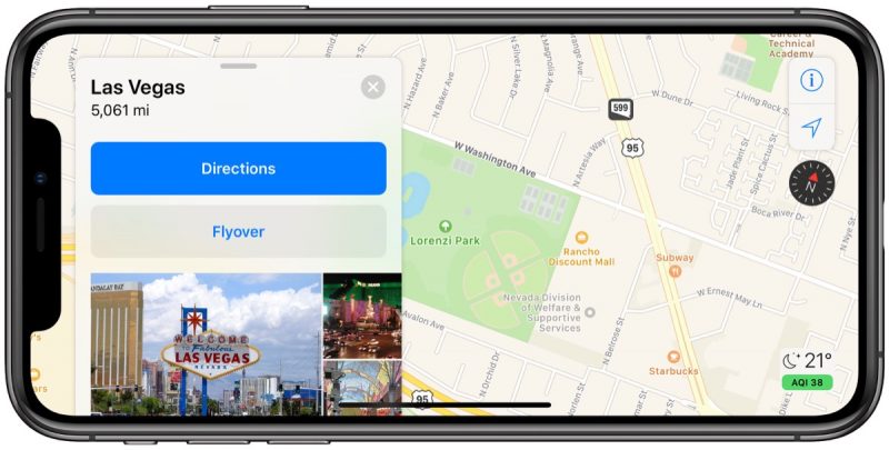
Speaking of more information and more accurate data, three areas of the United States had their maps recently updated on the Apple platform precisely to receive these news: the states of the Arizona It’s from New Mexico, as well as the southern state of Nevada (including Las Vegas).

With the novelty, the localities now have much more in-depth resources in mapping the terrain. Users can notice the changes simply by zooming in on the locations: elements such as soccer fields, trees, grassy areas and parking lots are much more detailed, creating a more immersive experience; search results are also smarter and more proactive.
The improvements are precisely the result of Apple’s mapping made with vehicles (and pedestrians) equipped with LiDAR sensors. According to the 9to5Mac, cities further north, such as New York, will receive news soon; states like Alaska, South Carolina and Tennessee have been mapped since March and will remain so until July.
Will we see these news here in Brazil, someday?
